
Comal County ZIP Code Coverage
Research identified 15 ZIP codes that touch Comal County. The list comes from a county-boundary geographic map source, not from a county-maintained postal table, so it is a useful geographic lead rather than final delivery proof. The postal-city wording is preserved because that wording is exactly where many record searches go wrong. A Boerne, San Antonio, Schertz, Blanco, San Marcos, or Wimberley label can still relate to the edge of Comal County. Check the individual address with USPS before attaching a delivery ZIP to a parcel record.
| ZIP | Areas or postal lead | Post office or station | Comal County note |
|---|---|---|---|
| 78006 | Boerne | Boerne | Touches the Comal and Kendall-area boundary; postal city is not New Braunfels |
| 78015 | Boerne | Boerne | County-touching ZIP, not a Comal city-limit label |
| 78070 | Spring Branch | Spring Branch | Standard ZIP for rural and northwest county area |
| 78130 | New Braunfels | New Braunfels, 651 N Business IH 35 Ste. 420 | Standard ZIP for central New Braunfels and a broad county service area |
| 78131 | New Braunfels | New Braunfels | PO Box ZIP, not normal situs-delivery geography |
| 78132 | New Braunfels and Canyon Lake | New Braunfels and Canyon Lake stations | Standard ZIP beyond one city label |
| 78133 | Canyon Lake | Canyon Lake | Standard ZIP for lake-area communities |
| 78135 | New Braunfels | New Braunfels | Standard New Braunfels-area addresses |
| 78154 | Schertz | Schertz | Crosses or approaches Comal, Guadalupe, and Bexar geography |
| 78163 | Bulverde | Bulverde | Standard Bulverde-area ZIP |
| 78266 | San Antonio | San Antonio | Touches the Comal and Bexar edge; postal city is outside Comal |
| 78606 | Blanco | Blanco | County-edge ZIP with postal city outside Comal |
| 78623 | Fischer | Fischer | Standard rural or county-edge area |
| 78666 | San Marcos | San Marcos | Crosses Comal and Hays geography; postal city is outside Comal |
| 78676 | Wimberley | Wimberley | County-edge ZIP with postal city outside Comal |
The Comal County ZIP-boundary source supports this starting list. USPS validation remains the address-level check, and the County Engineer's map layers remain the county and jurisdiction check.
Comal County ZIP Code Labels
Postal geography and county geography overlap without matching. New Braunfels, Canyon Lake, Spring Branch, Bulverde, and Sattler are all part of the county's address landscape, while the county edge can use a postal city that lies outside Comal County. The Comal and Guadalupe river corridors, Canyon Lake, downtown New Braunfels, and the IH-35 growth area each have different parcel and postal patterns. A ZIP code tells the Postal Service's routing story. It does not decide which city government or county custodian holds a record.
For a land or resident record, keep four entries apart: county, incorporated-city or ETJ status, situs address, and mailing address with ZIP. The County Engineer GIS and county map material are the appropriate sources for city-limit and ETJ context. A property's postal city may be New Braunfels even when the parcel is unincorporated, and the reverse mismatch can occur at the county edge.
Note: Postal labels are useful search terms, but county, parcel, and legal-description fields decide the correct local records path.
Comal County ZIP Code 78131
ZIP 78131 is the county's clearest postal exception. It is listed as a New Braunfels PO Box ZIP, not as a normal geography for a situs address. A PO Box can be a delivery destination for correspondence, but it should not be used to draw a parcel neighborhood or decide where a person lives. This matters when a tax account displays an owner mailing address that differs from the parcel's physical location.
Use the property location and GIS for the parcel, then verify the mailing or delivery ZIP separately. The same caution applies when comparing a recorded deed's mailing address to the legal description. Those two items answer different questions, even if both are associated with the same owner name.
USPS Validates Comal County ZIPs
The USPS ZIP Code Lookup is the final delivery check for a particular verified Comal address. Use it after GIS has located a situs parcel and before a record is labeled with a ZIP. That sequence prevents a postal label from standing in for parcel jurisdiction. The tool validates one address; it is not a ZIP-wide directory of county residents.
The captured USPS address-based lookup provides the official delivery-verification layer for the Comal County ZIP code directory.
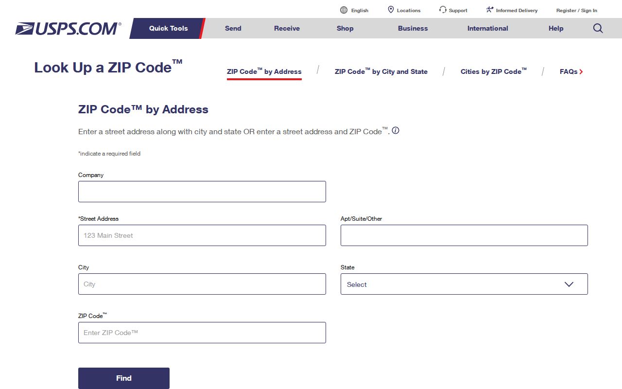
Its result should be recorded beside, not substituted for, the parcel situs, county, city-limit or ETJ status, and mailing address.
Note: USPS confirms delivery for an address, not the county record custodian or the parcel's municipal jurisdiction.
Comal County ZIP Search Availability
No documented county portal inspected for this project offers a verified ZIP-wide resident browse. The table distinguishes available fields from gaps. It is better to state that limit plainly than to imply a ZIP filter that the live text inspection did not show. The county property form is strong for a known address or owner; the voter-file request form is strong for documented county, district, and precinct requests; neither is published as a general ZIP directory.
| System | Documented input or filter | ZIP availability | Appropriate use |
|---|---|---|---|
| USPS ZIP Code Lookup | Verified situs or mailing address | Returns the delivery ZIP for that address | Final postal validation for one address |
| Comal Tax Assessor-Collector | Account number, owner name, owner address, property location, account type, activity, payment status | No visible ZIP field in the stable text form | Known parcel or address search, not ZIP-wide browse |
| County Engineer GIS | Map, parcel, road, subdivision, and jurisdiction layers | Advanced ZIP filters were not confirmed because the interactive app did not expose stable text fields | Parcel and city-limit or ETJ context |
| Texas voter-file request | County names, district numbers, precincts, status and other request choices | No published ZIP filter | Request Comal scope and confirm delivered layout and use terms before local filtering |
The tax search's owner-address input is a mailing-address field, not a postal-area browse. CAD or GIS advanced features may change, but the research did not document them as verified ZIP filters. Check the live application before relying on any newly displayed control.
Note: An unconfirmed map control should not be described as a Comal County ZIP filter until the live application documents it.
Find Residents in a Comal County ZIP
A ZIP can narrow an address question, but the official workflow stays address and parcel based. Use the postal code to confirm delivery geography, then use a county record with a documented search field. Do not treat a ZIP as a household roster or assume that every person in the postal area will be present in a tax, deed, or voter record.
- Start with a complete address and use the county property search or GIS to establish the situs parcel.
- Run that verified address through USPS to confirm the delivery ZIP.
- Record county, city-limit or ETJ status, situs, mailing address, and ZIP in separate fields before comparing records.
- Use the owner, parcel account, or legal description in the deed index if the question concerns land ownership or prior transfers.
- Once the ZIP is narrowed to a road, use the Comal County street directory process for the full address-level trail.
Texas voter-file requests can be scoped by county and precinct, but the published form does not offer a ZIP filter. A delivered record layout and the current statutory use instructions should be confirmed before any local analysis.
Comal County ZIP Code City Limits
New Braunfels postal wording does not establish New Braunfels city limits, Comal County parcel jurisdiction, or a city service boundary. A county parcel can carry a Boerne, San Antonio, Schertz, San Marcos, Blanco, Wimberley, Spring Branch, Canyon Lake, or Bulverde label. The County Map Book and GIS city-limit or ETJ layers are the geographic check. This mismatch is especially important at county edges and in fast-growing areas where development, postal routing, and municipal boundaries do not move together.
Postal boundary check. Confirm the USPS delivery ZIP for the address, then use Comal County GIS to verify the parcel's county and city-limit or ETJ setting.
- ZIP versus ZIP+4
- A ZIP identifies a broader postal area. ZIP+4 adds a delivery segment for a more precise mailing route.
- PO Box ZIP
- A ZIP used for post-office boxes. It is a delivery label, not proof of a parcel location.
- Unique ZIP
- A ZIP assigned to one organization or delivery arrangement. No such Comal-specific unique ZIP was documented in the research.
- Carrier route
- A Postal Service delivery route inside a ZIP area. It is not a city-limit or household boundary.
Comal County ZIP Code Growth
Comal County's population rose from 161,501 in the 2020 Census to a 2025 estimate of 209,166. The increase helps explain why a county address search cannot be reduced to one city name or one old directory pattern. New subdivisions may first appear in the Engineer's active-plat and GIS systems, while postal wording can still point to a familiar nearby community. Parcel, plat, and postal checks need to remain separate as the county grows.
The Census QuickFacts entry for Comal County is the source for those countywide figures. They describe the county as a whole, not a population count for any individual ZIP.
Note: Countywide growth figures do not prove a boundary change or population total for any individual ZIP code.
Comal County ZIP Code Subdivisions
At a new subdivision, a street address, parcel account, subdivision and lot or block, metes-and-bounds description, city-limit or ETJ status, and ZIP can all be separate keys. County plat materials distinguish city limits, ETJ, and unincorporated or outside-ETJ locations. Plat applications also track acreage, lots, roads, drainage, water, wastewater, floodplain, and Edwards Aquifer or recharge-zone context. Those details explain why one postal label cannot settle a land-record question.
The Comal County Address Request guidance directs users to view addresses through GIS and describes the local address path.
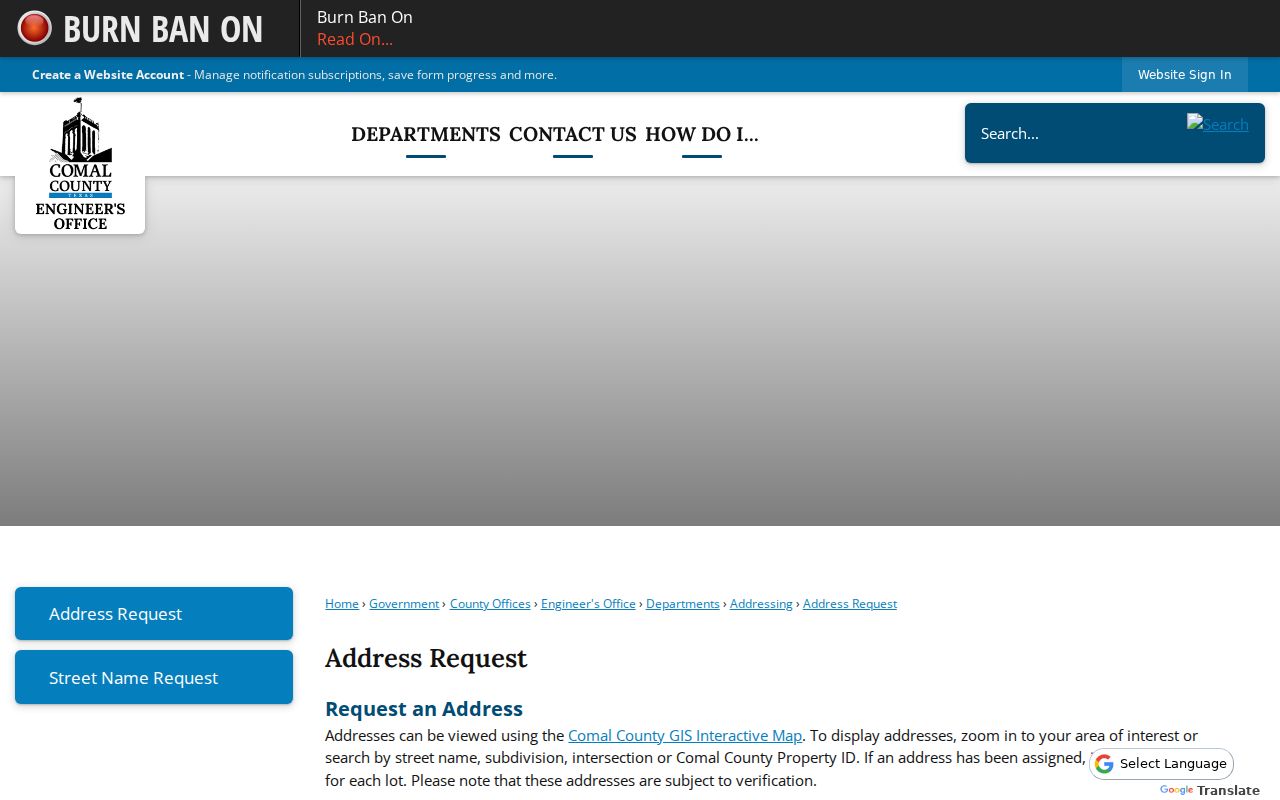
Use the county address and map layer to identify the physical location before using a ZIP code as the delivery reference.
Limits of Comal County ZIP Directory
A ZIP code directory does not identify all people in an area. Tax and deed records focus on parcels and ownership. A voter record can be protected or absent, and the state's individual status service is not a public household list. A postal delivery code does not prove current residence, ownership, or city jurisdiction. Use a result only for the specific fact that its custodian records, and confirm mismatches with the office that maintains that fact.
For a particular Comal County address, the safe sequence is parcel first, postal delivery second, and record-type verification last. That keeps a postal search useful without turning it into a claim about everyone in a neighborhood.