
Search a Comal County Street
Use the address as a chain of records, not as proof that every person connected with it lives there. The Comal County Tax Assessor-Collector distinguishes the actual property location from an owner mailing address. That makes the property-location result the sound opening point for an address search. From there, the county map can place the parcel among nearby lots, the Clerk can connect it to a deed, and older directory material can add a dated household lead. Each source has a different purpose.
- Search the exact situs in the Comal County online tax and property search. Save the account number, listed owner, and property-location wording.
- Open the same area in the Comal County Engineer GIS. Compare the parcel with roads, subdivision context, and adjoining shapes, remembering that map lines are approximate.
- Use the owner name and legal description in the County Clerk ROAM public records portal. A purchase deed identifies the grantee, grantor, date, and instrument trail.
- For a dated registration question, use the Texas voter-file request path by county and precinct. The individual VoteTexas status tool is not an advertised street-browse list.
- For an older address, check reverse or criss-cross directory holdings, then read the alphabetical entry for the same person and year.
That order prevents a common error: treating the tax mailing field, a map label, or a directory entry as a current household roster. Note: Keep the account number and legal description with every result so same-name or same-street records can be checked later.
Comal County Street Address Keys
The Comal County Tax Assessor-Collector Online Taxes form has four documented search keys: account number, owner name, owner address, and property location. For a street-level task, choose Property Location for the actual parcel address. Enter the street number and street name, but leave off the street type and direction. The portal gives the pattern 100 Weatherford, rather than a form with a suffix such as Dr. Owner Address means the owner's mailing destination, which may be somewhere else.
Owner-name search uses last name followed by a space and a first name or initial. Account numbers require dashes. These details help when an address search does not return a clear parcel. The page also exposes account-type, inactive-account, and payment-status controls. None of those controls turns a property result into proof of current residence. The Comal Appraisal District is a separate source for informational appraisal and exemption data, updated each business day according to its site.
Note: A situs address identifies a parcel; a mailing address is correspondence information tied to the account and should be recorded separately.
Comal County Street Search Fields
The property form's visible fields are useful because they define what the county actually documents. Use the least broad search that fits the address. The documented text does not show a ZIP-wide field or a one-click export for every address on a road, so a street-level result may require separate parcel checks and GIS browsing.
| Field or control | Type | Required | Comal County format or option |
|---|---|---|---|
| Search By | Dropdown | No visible marker | Account Number, Owner Name, Owner Address, or Property Location |
| Search text | Text | No | Value changes with the selected search key |
| Account Type | Dropdown | No | Options were not expanded in the documented inspection |
| Include Inactive Accounts | Radio | No | Yes or No |
| Pay Status | Radio | No | Both, Paid, or Unpaid |
| Search | Button | Not applicable | Submits the selected query |
The documented result inventory separates owner name, owner mailing address, property location or situs, account number, account type, account activity, and payment status. CAD appraisal or exemption information comes from the related appraisal source, while GIS map geometry remains a separate, approximate layer. This division matters when comparing several parcels along one Comal County street.
The captured tax-property search shows the controls used for this Comal County address-first process.
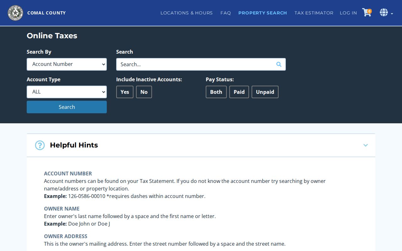
The search screen reinforces why property location and owner mailing address should not be merged into one field when tracking a parcel.
Map a Comal County Street Segment
The County Engineer GIS and Open Data site is map-first. Search or pan to a road segment, turn on parcel and road layers, then select the target parcel. Where the live application provides it, the identify tool can expose parcel attributes or a link toward the property record. Subdivision, district, flood, and other layers add context that a street name cannot supply. The county cautions that GIS lines are informational and not a legal survey.
Use the Plat Viewer when a street address needs a lot-and-block bridge. A recorded plat or replat may explain a subdivision name, road layout, and legal geometry even when the deed does not carry the familiar street number. For an unincorporated road, GIS and the County Engineer's address resources are usually more relevant than a municipal permit page.
- Parcel
- A mapped unit of land used in tax and appraisal work. Its map outline is useful context, not a surveyed boundary.
- Situs address
- The actual physical property location. It is different from the address used for tax correspondence.
- Plat
- A recorded subdivision or land map that can connect a street address to a lot, block, or legal description.
- Criss-cross directory
- A reverse directory arranged by address, used to find a dated occupant entry before checking the alphabetical listing.
Deeds Along a Comal County Street
A deed chain begins after the parcel is identified. Copy the current owner, account number, subdivision, lot and block or metes-and-bounds description. In ROAM, select Official Public Records and search the current owner as grantee. The purchase instrument identifies a seller or grantor. Search that seller as an earlier grantee, and use the legal description to confirm that the trail stays on the same land. The same street name or a shared surname is not enough.
The Clerk's quick-tip material documents filters for index type, party role, recorded date, and document type. ROAM's landing page does not state a full online coverage start year. When a needed record is not online, the Clerk's written request form accepts document-specific details, including instrument number, volume or page, document date, grantor, grantee, and legal description. The Clerk lists real-property written searches at $10 per grantor or grantee name for up to ten years, plus copy and certification charges.
The ROAM public-access screen is the manifest source for the Comal County street directory's recorded-instrument layer; the TSLAC microfilm guide is the documented fallback for deeds and indexes when online coverage is unclear.
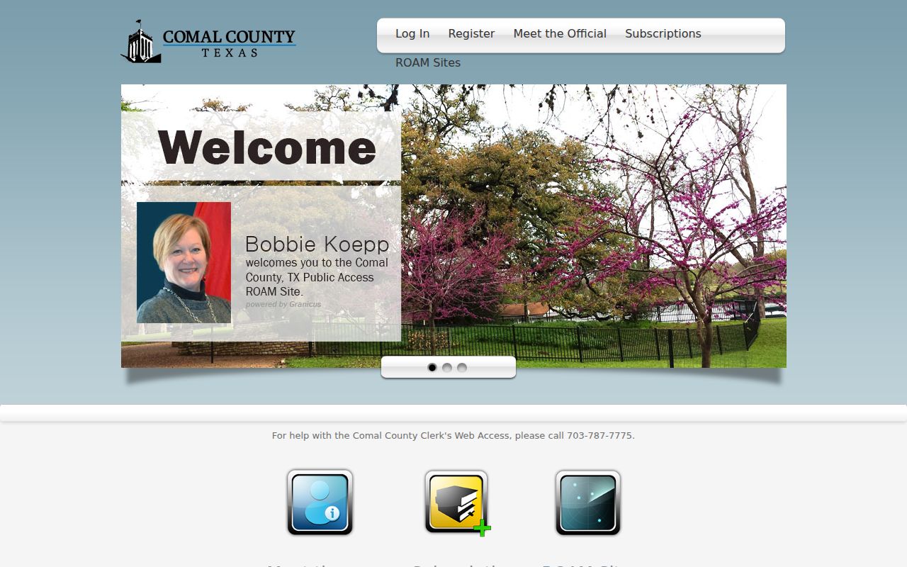
The ROAM landing controls show the registration, sign-in, and subscription path that should be checked before assuming an image is available.
Comal County Street Permit Clues
Address records can include a dated project trail. New Braunfels Building Safety's permit search allows searches by address, permit number, or general location for active permits. A result may supply a project description, status, dates, applicant or contractor, and an address, though the research inspection did not expose a complete field inventory. Pair a permit with the parcel and deed record. It can document work at an address, but it is not an ownership record.
New Braunfels records do not cover every Comal County road. In unincorporated areas, use County Engineer subdivision, driveway, floodplain, utility, and GIS resources. The county code-compliance path is a reporting route, and the research did not locate a stable public historical address-case index. That gap should remain visible instead of being filled with an assumed search function.
The New Braunfels permit-search screen is a useful city-layer image for Comal County address research.
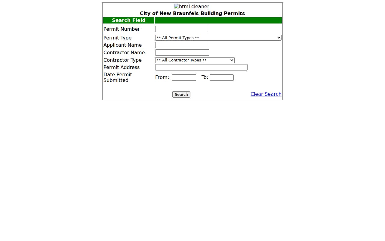
Use the address search as a project clue, then compare its date and location with the parcel and recorded-document trail.
Comal County Street Address Changes
Comal County Order 411 gives the Address Coordinator authority over county addresses. The county address-request guidance says that addresses can be viewed through the county GIS map, while written requests can be required. The order allows corrections for duplicate and out-of-sequence numbers, as well as odd or even numbers on the wrong side of a road. Multi-unit numbering can also change the form of a historic address.
For an older Comal County directory entry, preserve the old and current address forms, nearby cross streets, subdivision, lot or block, and legal description. A directory number that fails in the modern tax search may still point to the right parcel once those other keys are matched. Do not conclude that an address vanished solely because its current postal string differs.
Note: Address correction rules explain a mismatch between a historical entry and a current parcel search, but they do not identify a present household.
Comal County Street Record Coverage
Several address-keyed sources can be used together, but they answer different questions. The tax account establishes an ownership and billing lead. GIS places the land. Plats provide legal subdivision context. Recorded instruments follow title. A permit can date work. The voter-file request process has different rules and does not act as a ready-made street browse. Older directories serve a historical layer rather than a current one.
| Address record | Comal County keeper | What it can show | Documented access |
|---|---|---|---|
| Tax account | Tax Assessor-Collector | Owner, mailing address, situs, account, and payment status | Free online search by owner, owner address, property location, or account |
| Appraisal card | Comal Appraisal District | Informational property, value, and exemption data | CAD search and interactive map; historical cutoff not stated |
| GIS parcel | County Engineer | Approximate parcel shape, road, neighboring parcels, and district layers | Interactive GIS and open data |
| Plat or replat | County Clerk and Engineer | Subdivision, lot, block, revisions, roads, and legal geometry | Plat Viewer provides unofficial downloads; Clerk provides certified copies |
| Deed index | County Clerk ROAM and TSLAC microfilm | Grantor, grantee, date, instrument, and legal description | ROAM public access; copies may cost; microfilm begins in 1846 |
| Permit | New Braunfels or County Engineer | Published project, address, status, date, applicant, or contractor fields | New Braunfels active search; county coverage varies |
| Voter file | County Registrar and Texas Secretary of State | Requested registration and precinct information subject to legal limits | Individual status route or public-information request |
A street name is the shared reference point, but the parcel account and legal description do the work of tying records together. For historical volumes, the Comal County city directory collection has the fuller directory-shelf context.
Older Comal County Street Listings
Reverse or criss-cross directories offer a dated address-first route when a volume exists. Look up the address in the reverse section, then move to the alphabetical section for the person's related entry, such as a spouse, telephone, or address notation where printed. The Texas State Library and Archives Commission lists verified New Braunfels city-directory years of 1952–53, 1969, and 1975. The UT Briscoe Center inventory also identifies regional directory material, including a Polk run for 2001–2004.
Where no reverse volume survives, use the local newspaper archive, Comal County Genealogy Society indexes, and the library route rather than inventing a continuous street list. A past occupant is time-specific. It should be matched to a year and the original directory or page, then checked against a deed or parcel record if the address has changed.
Comal County Street Records Since 1846
Comal County was created in 1846, and the earliest local land trail is stronger on archival material than on a modern landing page. The TSLAC catalog documents deed records beginning in 1846, alongside early marriage, naturalization, survey, and preemption material. That long record span matters for an old Comal County street, particularly where a new street number is not printed in the first instrument. Legal descriptions, grants, lots, blocks, and nearby roads can bridge the eras.
One useful catalog detail prevents a false dead end: the early Comal Deed Record series has no Volume J. A gap at that letter does not prove that a deed or person is missing. Check adjacent volumes, the direct and reverse index, and the Clerk's records path before stopping. This archival continuity is the local story behind careful street-by-street research.
Note: The current ROAM landing page does not publish a complete online start year, so microfilm remains the stated fallback for earlier deed research.
Limits of Comal County Street Records
A property owner, a tax mailing destination, a registered voter, an applicant on a permit, and a past directory entry are not interchangeable labels. Some residents will not appear in a property record or voter file. Texas confidentiality rules can protect eligible voter residence information, and the Attorney General's Address Confidentiality Program uses substitute mailing arrangements for qualified participants. Public utility customer lists and motor-vehicle address data are not general resident-search sources.
Lawful use. Comal County street and address records are for personal, civic, family-history, and property research. Do not use them to stalk, harass, intimidate, or harm anyone.
When the goal becomes confirming one named person rather than understanding a street, use the county and state custodians for the record type involved. Match the person, address, date, and jurisdiction before relying on any single result.